Tuesday, March 4, 2025–10:00 a.m.
-National Weather Service-

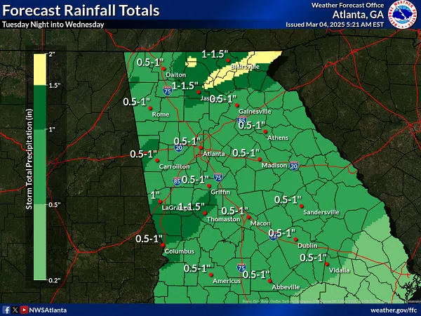
The potential remains for severe weather associated with a line of heavy showers and embedded thunderstorms that will race across the area tonight into early Wednesday morning. Please share this information with your employees, staff, family, and friends to ensure they remain weather-aware of our current situation.
BOTTOM LINE UP FRONT / OVERVIEW:
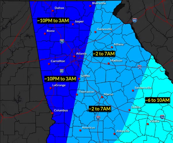
- A line of heavier showers and a few embedded thunderstorms will move across the area tonight into Wednesday morning, resulting in areas of strong/damaging winds.
- Due to the rapid movement of these storms, the “window” of opportunity to see the strongest winds/heaviest rainfall will be less than 3 hours.
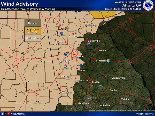
- Strong gradient winds will also occur outside of rain and storms with gusts as high as 35-45 mph not associated with storms. A Wind Advisory has been extended in time for the western portion of our area beginning this afternoon and continuing until 7 AM Wednesday. This advisory could be further extended in time and/or area with future updates.
WHAT:
- Strong to Damaging wind gusts > 60 MPH
- Brief tornado possible
WHERE & WHEN:
- All of north & central Georgia
- Storms will progress into west Georgia late this evening, moving eastward across the remainder of the area through Wednesday morning, likely from roughly 10 PM Tuesday to 10 AM Wednesday
IMPACTS:
- The gusty/strong winds could take down trees and powerlines. Minor structural damage is possible as well.
FORECAST CONFIDENCE:
- Continued fairly HIGH confidence in all forecast elements at this time